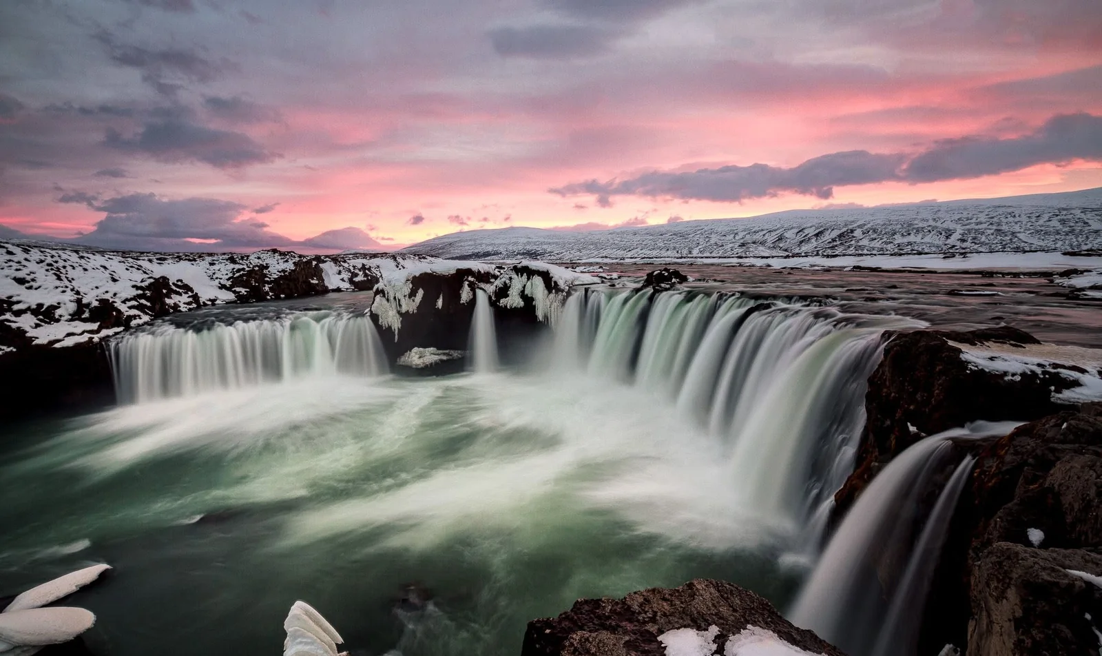

Goðafoss sits in the Skjálfandafljót river in Þingeyjarsveit, right by Route 1. From Reykjavík the fully paved Ring Road route through Vaðlaheiðargöng is 422 km, according to Vegagerðin. From Akureyri the same tunnel route is 34 km. You can reach both banks, walk on marked paths to built viewpoints, and see the falls throughout the year. The drive from Reykjavík is a long one on Route 1, so many people stop here on the way to or from Akureyri or Mývatn rather than as a round trip in a single day.
Gunnar Steinn's advice for a first visit is simple: "Give yourself a little time. This is a magnificent waterfall, and ideally you should see it from both sides."
How do you get to Goðafoss from Reykjavík?
The usual way is to drive north on Route 1, the Ring Road. Vegagerðin lists the fully paved route from Reykjavík to Goðafoss at 422 km, via Hvalfjarðargöng, Holtavörðuheiði, Vatnsskarð, Öxnadalsheiði and Vaðlaheiðargöng. A slightly shorter listed route of 415 km uses the Svínavatn roads and includes 18 km of gravel; the fully paved Route 1 option is the one most visitors should plan for.
A still shorter figure of 399 km appears on the same official list, but that line uses highland F-roads, including Sprengisandsleið, which Vegagerðin says are open only part of the summer and are not for ordinary passenger cars.
Before you leave, and again on the road, check conditions on umferdin.is. Vegagerðin's road information number is 1777. SafeTravel advises you to match your speed to the road, keep your eyes on the road, and only stop for photographs in a safe place off the carriageway. Weather and warnings belong on the Icelandic Met Office site, including its alerts. In an emergency, call 112.
The Ring Road is Iceland's main year-round highway, but stretches in the north can still be slippery or closed in poor weather. See our guides to driving in Iceland and driving in winter. Goðafoss is also a natural stop in a Ring Road itinerary after Akureyri, on the way toward Mývatn.
How far is Goðafoss from Akureyri?
Akureyri is the useful second starting point. Vegagerðin lists 34 km from Akureyri to Goðafoss on the paved route through Vaðlaheiðargöng. The Environment Agency's management plan for the protected site, confirmed in April 2023, likewise places the falls about 34 km east of Akureyri, at the mouth of Bárðardalur, beside Route 1.
If you prefer to avoid the tunnel, Vegagerðin lists a fully paved route of 50 km via Víkurskarð, about 16 km longer than the tunnel route, which matches the agency's general note on those two options.
Vaðlaheiðargöng is a toll tunnel. The operator's tariff, in force from 2 March 2026, lists a single trip for a vehicle under 3.5 tonnes at ISK 2,216, paid at veggjald.is or tunnel.is, or later in online banking. The official payment window for a single trip is 24 hours before or after you drive through. Check the operator's site for the rate that applies to your vehicle.
If you stay in Akureyri overnight, our Akureyri guide and food article may help, and you can continue to the falls the next day. A Goðafoss tour from the Akureyri port is listed for visitors arriving by ship.
East of the falls, the fully paved Route 1 distance from Goðafoss to Reykjahlíð by Mývatn is 49 km. That makes Goðafoss a straightforward stop on a north-east day, not a separate expedition.
East bank or west bank?
You can, and should, see both sides if conditions allow. The Environment Agency plan is clear on the layout.
Gunnar Steinn usually starts on the west bank: "There have usually been fewer people there when I have come, and I think the falls look good from that side, but it is a longer walk." The Environment Agency plan notes that the west side has no winter service on its paths or at the car park, and it encourages winter visitors to use the east approach.
The west side is reached from Route 1 along Goðafossvegur (road 883). The car park there is split for ordinary traffic and coaches, with further spaces for camper vans, cars with trailers, and disabled visitors. The west path leads from the parking area to two viewing platforms, linked by concrete steps. The lower platform has a bench and a railing; the upper one has a railing as well. A path also runs along the river and joins the main walk in two places on the way to the footbridge.
The east side is reached from Bárðardalsvegur eystri (road 844). The car park is again split for ordinary cars and coaches. Paths lead from the parking area, and from the service building at Fosshóll, to a concrete viewpoint and two further viewpoints. The agency says the view of the falls is unobstructed and that it is possible to look at Goðafoss all year. Access for wheelchair users is described from the car parks to the viewing platforms on both the east and the west sides. To go down closer to the river there are wide gravel paths.
A footbridge over Skjálfandafljót links the two banks, so you can walk from one side to the other without returning to the car. Stay on the marked paths. The plan makes that a rule for visitors, with an exception only for people who are fishing with a rod. Pets must be on a leash and under control, except for working service dogs.
On the east side, at Fosshóll, the agency notes lodgings, a place to eat, a souvenir shop and toilets. Confirm opening times on the day if you need them. There is no waste collection point inside the protected area, so take your rubbish with you.
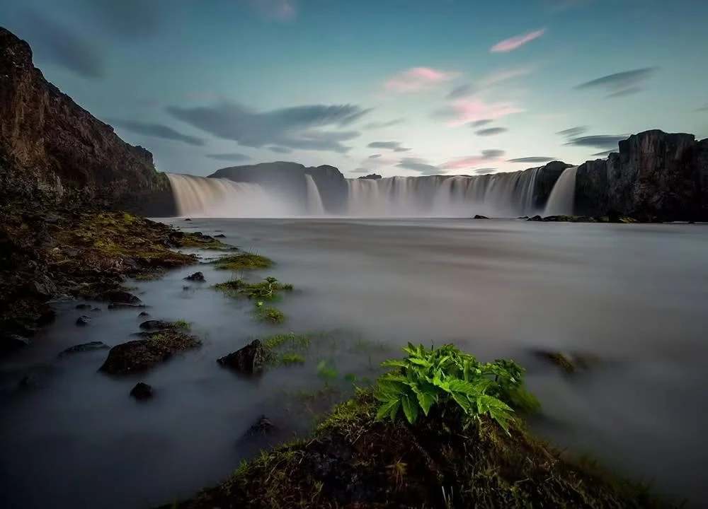
Goðafoss. Photo: Gunnar Steinn
Can you visit Goðafoss in winter?
Yes. The official plan says you can look at the falls all year, and the viewpoints are built for that. Winter still changes how you should arrive.
For safety, the steps down to the river on the east side are closed in winter. There is no winter service on the west side, neither on the paths nor at the car park, and visitors are encouraged to use the eastern approach in winter. There is winter service on part of the site, which in practice means planning for the east bank first, then seeing whether the bridge and the west paths are in a condition you are happy to use.
Ice, wind and spray can make paths slippery even when the main road is clear. SafeTravel says to use a car with proper winter equipment, including winter tyres; to keep front and rear lights on at all times, which is required in Iceland; to clear snow and ice from windows, mirrors, lights and the roof; and not to treat four-wheel drive as a guarantee against skidding. Check umferdin.is, the Met Office and SafeTravel before you go.
In Gunnar Steinn's view, Goðafoss is far more beautiful in winter: "Ice can build up on the outside of the falls and change how it looks. By the same token, you have to be very careful because of ice and slippery ground."
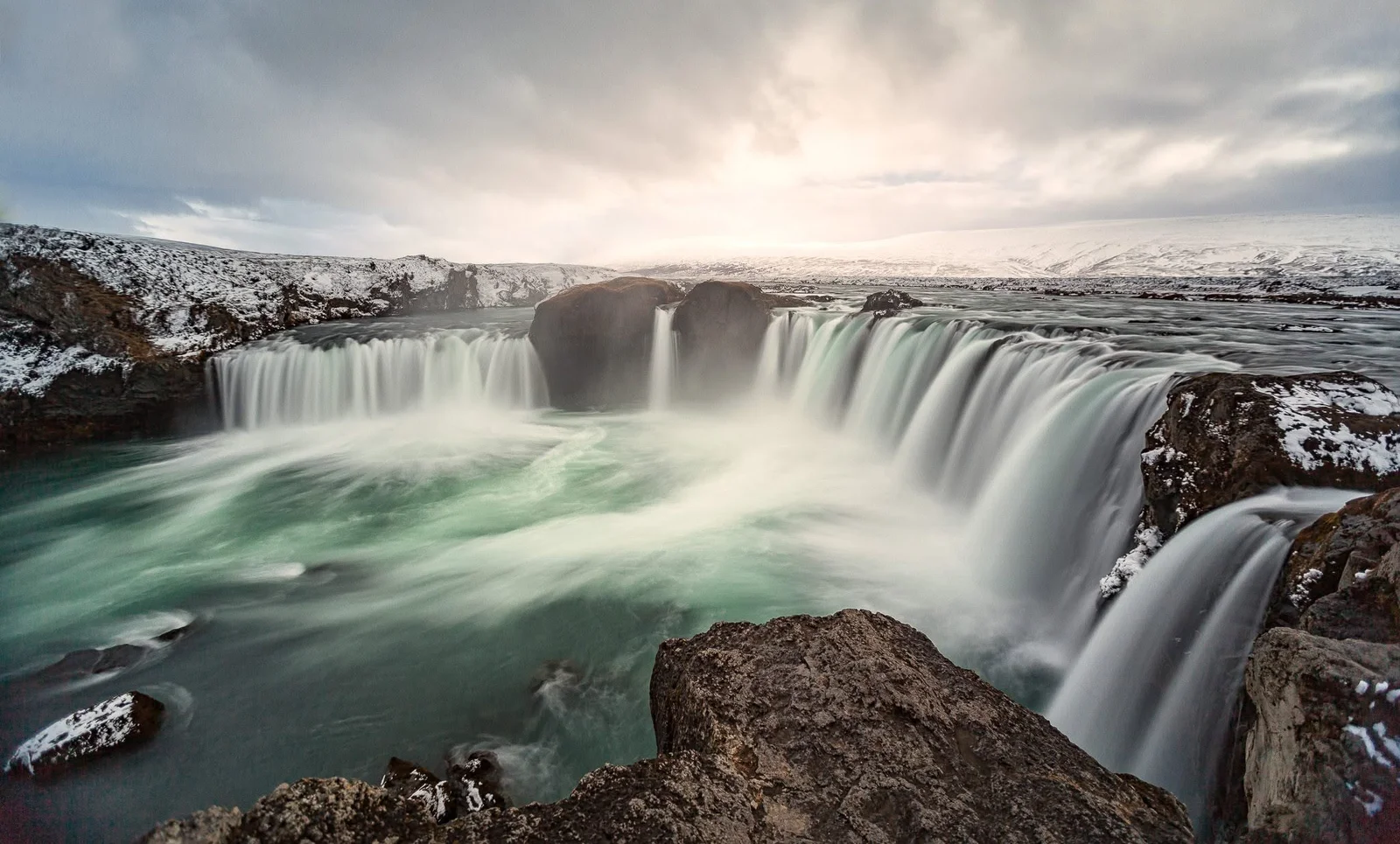
Goðafoss in winter. Photo: Gunnar Steinn
What will you see at the falls?
Goðafoss is protected as a natural monument. The Environment Agency protected it on 11 June 2020. The protected area is 0.224 km². The aim is to protect distinctive natural features, the variety of the geology and the waterfall itself, including its natural flow, as well as the beauty, character and outdoor value of the place.
The 2023 plan describes Goðafoss as among the larger waterfalls in Iceland and one of the most voluminous. The river is Skjálfandafljót, a glacial river that also receives a good deal of spring water, rising in the north-west of Vatnajökull. It is about 180 km long, the fourth longest in the country, and has cut a gorge about 3 km long, around 100 m wide just below the falls.
The falls split into two main drops, 9 to 17 metres high, coming over the lava at an angle toward each other, plus several smaller falls. The look of the place changes with the volume of water, the weather and the season. The plan mentions distinctive potholes in the gorge, with a strong suction in them. Keep to the paths and the railings.
The land on the west bank is called Hrútey, bounded by Hrúteyjarkvísl, a channel that leaves Skjálfandafljót above the falls and meets the river again further down.
If you are collecting waterfalls on a longer trip, our guide to Iceland's waterfalls sits alongside this page rather than replacing it. This article is the place page for Goðafoss.
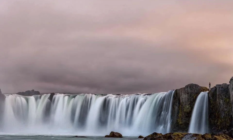
Goðafoss. Photo: Gunnar Steinn
Why is it called Goðafoss?
A folk story, recorded in the Environment Agency plan, gives the name. It says that Þorgeir Þorkelsson Ljósvetningagoði threw his chieftain's god-images into the falls after he was given the task of settling the law between heathen and Christian parties, and after he had taken up the new faith. The falls are said to take their name from that event.
Present it as a tradition, which is how the official plan presents it (as a þjóðsaga, a folk story), not as a dated historical fact you can verify from the riverbank. A sign near the footbridge and another at a viewpoint tell the story of the falls.
Can you see the northern lights at Goðafoss?
On a dark, clear night, Goðafoss is a natural place to look up, like many open sites in the north. Kp 2 or higher means the aurora is possible in Iceland when the sky is clear. The forecast for tonight belongs on williseeaurora.com, not on a weather page and not on this article. For the travel side, see our northern lights guide and camera settings article, or our northern lights tours.
In winter the same path rules apply after dark, and the eastern approach is still the one to use when the west side is not winter serviced. Take a torch for the walk back to the car, stay on the marked paths, and do not step toward the unfenced river for a photograph.
What should you bring, and what should you check?
You do not need a long hike to see the falls, but you are still outdoors by a powerful river in the north. Wind and spray can make the viewpoints cold even in summer. Our packing guide covers clothing. Sturdy shoes matter at a wet railing.
On the day:
- Road conditions: umferdin.is and 1777.
- Weather and warnings: en.vedur.is and alerts.
- Winter driving: SafeTravel.
- Tunnel payment, if you use Vaðlaheiðargöng: veggjald.is.
- The protected site and its rules: the Environment Agency's Goðafoss page.
Stay on the paths, keep pets on a leash, and take your rubbish with you. A drone in a protected area needs an Environment Agency permit; apply before you go, and never fly over people or close to birds.
Frequently Asked Questions
How far is Goðafoss from Reykjavík? Vegagerðin lists 422 km on the fully paved Ring Road route through Vaðlaheiðargöng. That is the route to plan from Reykjavík.
How far is Goðafoss from Akureyri? 34 km on the paved route through Vaðlaheiðargöng, or 50 km on the paved route via Víkurskarð, according to Vegagerðin.
Do you need to walk both sides? You get a fuller view if you do, and a footbridge links the banks. If you only have time or safe access for one side, use the east approach in winter, when the west side has no winter service.
Is Goðafoss open in winter? The site can be visited all year and the falls can be viewed from the platforms. In winter the steps down to the river on the east side are closed, and visitors are encouraged to arrive from the east.
Is there a parking fee? The Environment Agency plan describes official car parks on both sides but does not state a fee. Follow the signs on the day rather than relying on an old figure.
How high is Goðafoss? The two main falls are 9 to 17 metres high, according to the Environment Agency's 2023 management plan. The look of the falls changes with the river's flow, the weather and the season.
Where does the name come from? A folk story in the official plan says Þorgeir Ljósvetningagoði threw his god-images into the falls when Iceland took up Christianity. Treat it as a tradition recorded by the agency, not as a fact you can see in the water.