Iceland's South Coast is a breathtaking location that provides a singular fusion of outstanding natural beauty and rich cultural history.
With its majestic glaciers, towering waterfalls, black sand beaches, and towering cliffs, this area is a photographer's dream.
Many historic monuments, including Viking, remains and fishing communities, offer an insight into Iceland's history.
The South Coast of Iceland is a must-see for outdoor and culture enthusiasts alike.


Due to its geological and historical significance Þingvellir is the most significant place in the history of Iceland.
In 1928, the area was established as the first national park in the country. It has also been recognized as a world heritage site by UNESCO.
Þingvellir is one of Iceland's most visited places and one of the three stops on the popular "Golden Circle" tour.
The name Þingvellir literally means "Assembly Plains," and this region has represented Iceland's history.
The Alþing, or parliament of Iceland, was founded there in 930.It was the world's oldest functional parliament at the time, and it met there on the banks of the Öxará River for 868 years, or until 1798.
Icelanders view that region as the birthplace of their country because so many important historical events occurred there.
According to Ari fróði's Íslendingabók, it's believed that Ingólfur Arnarson first got to land in Reykjavik during the 870 AD period.
Following in his footsteps, many people started to see Iceland as a promising place to live. The country's population continued to increase, and soon it required a specific place to meet and resolve disputes.

Before 930, chieftains sent a man known as Úlfljótur to Norway to study the customs and laws of the new society.
He eventually returned to Iceland and established the first law that was used at the Alþing. His foster brother, Grímur geitskór, then went around the country to find a suitable meeting place for the Alþing.
In 930, it was decided that the general assembly of Iceland should be held at Bláskógar. This event, which marked the beginning of the country's history, took place at the Þingvellir.
According to Íslendingabók, Þórir Kroppinskeggur was a prominent individual who owned land in the area and killed his servant and as punishment, his land would pass into common ownership for the use of the Alþing.
Given its excellent pasture, water, and firewood, the Þingvellir was regarded as a desirable location. Due to its flat plains contrasting with rocky cliffs, the location was also perfect for the meeting place.
During the last glacial period, a layer of ice, more than 1000 meters thick, covered the land. Despite the cold, there was a widespread volcanic activity under the glacier.
This process produced tuffs. Some of these volcanic eruptions managed to melt through the glacial shield and ended in lava flows that formed palagonite mountains or long palagonite ridges.
After the glacier retreated to the north, a glacial lagoon formed to the south of it, close to the Grafningsfjall mountain. The area's underground volcanic activity produced a number of different types of mountains that were encircled by lengthy palagonite ridges.
Over 18,000 years ago, when the temperature rose, the glacier began to melt and eventually recede. The first indication of Lake Þingvallavatn came 6,000 years later.Eventually, the glacier stopped moving and retreated.
About 10,000 years later, a shield volcano formed under the glacier. This region, which was called Skjaldbreiður, became one of the most prominent shield volcanoes in Iceland. The eruption that created this volcano lasted for several decades.

During this period, the lava collected the area's glacial run-off water, which then flowed south into the depression.
All of the water from the north that had been flowing through the lava disappeared into clear spring water.The lava from the shield volcano, which was south of Hrafnabjörg, flowed into the lake and blocked the outlet of Sogshorn.
The water level continued to rise, but it decreased as the lava flowed through the depression. As the lava flowed through the depression, it caused land subsidence and rifting. Eventually, a cross-section of the lava appeared in the rift walls that are clearly visible today.
Sometime around 3,000 years ago, an eruptive fissure appeared near Hrafnabjörg and formed Þjófahraun. The lava from this fissure flowed out east of the Tindaskagi ridge, but some went northwest of the area.The last eruption in the Þingvellir depression occurred in 2000 years.
The lava from the fissure flowed into Grafningur and then into Lake Þingvallavatn. The ash from the eruption created a scar on the bottom of the lake. Although the activity in the area has been dormant for the last 2000 years, it's not clear if the volcano will erupt again.
Lake Þingvallavatn is the second largest lake in Iceland, covering 83 km2, with a mean depth of 34 m and being fed mostly by cold (3-4°C), making it one of Iceland's coldest lakes.
The relationship between the geological history and the ecosystem of Lake Þingvallavatn has made it one of the most unique lakes in the world.
Due to the various natural processes that have occurred in the area, such as land subsidence and lava flow, the lake has a diverse ecosystem.
The high levels of minerals found in the groundwater are the result of the young age of the lava. This is one of the reasons why the ecosystem in the lake is diverse.


There are 172 native species of vascular plants in Iceland's National Park.
These are all significant elements that add to the ecosystem's diversity in the lake.
The numerous species of birch, willow, dwarf birch, and heath family plants change the aspect of the lake in the autumn.
Since the settlement of Iceland, the fox has been able to share the countryside with humans.
It can be seen in various areas, such as the lake Þingvallavatn.
Minks are the newest addition to the lake. These animals were originally brought to Iceland in 1931 for their fur.
After a few of these animals escaped from their cages, they became more common throughout the country.


Since the lake is deep, it doesn't attract as many ducks as other shallow lakes, such as Lake Mývatn.
There are 52 bird species living in the lake, and 30 of them come and go.
One of the most popular bird species that live in the lake is the northern diver, which nests in various parts of the lake.
Iceland is also known as the easternmost point where the great northern diver originated.
Other migratory birds from North America that live in the area include the harlequin duck, the goldeneye, and the barrow's goldeneye.
White-tail eagles, which are known to nest on the slopes of Arnarfell, (Eagle-mountain) are rarely seen here.
The brown trout is one of the most prevalent freshwater fish species in Iceland's lakes.
Three different species can be found in Þingvallavatn, the three-spine stickleback, Arctic charr, and brown trout, the latter of which is the largest.
The fish are thought to have become isolated in the lake due to changing terrain during the last ice age.
The lake's continual groundwater inflow has produced a range of habitats for different living forms, including the fish, resulting in a natural process of evolution taking place in the lake.


The Geysir area has been active for over a thousand years.
The oldest known stories of the area's activity dates back to 1294.It features boiling mud pits and bursting geysers, and is a popular stop along the Golden Circle route.
If you're looking for a full field of geysers, strangely colored sulfurous mud pots, hissing steam vents, warm streams, primitive plants, steam, and smoke in a Geothermal active atmosphere, this is the place to be.
Geysir or The Great Geysir eruptions can hurl boiling water up to 122 meters into the air and can last up to two days.
Although these natural phenomena are usually infrequent, they have stopped completely for several years at a time.
After several years of being dormant, the Geysir started erupting following an earthquake in 2000. It continued to erupt for several years following the powerful earthquake.
The Great Geysir was the first geyser to be written about in print. Even though it is no longer as active, other hot springs around the world bear its name.
Geysir is the most famous geyser in the world, along with Old Faithful in America's Yellowstone National Park.
Nowadays, it's mostly dormant, though other hot springs in the area are still active. But no one knows when The Great Geysir will wake up again.


Another popular hot spring in the area is the Strokkur, which produces hot water that rises as high as 30 meters into the air.
The Strokkur's magnificent pool is a sight to behold but take caution: the water is about 90 degrees Celsius (194°F) in temperature.
Hot water that is approximately 112 degrees Celsius (233°F)
is also contained within its water shaft.
The water of the Strokkur begins to boil before it erupts. It sways and boils as the steam rises from its surface.
The water will then burst into the air before falling into the pool.
Strokkur erupts approximately every four to ten minutes, so don't worry about missing this breathtaking display of nature; just be sure to have your camera ready next time!
It's not exactly clear when the Geysir was first created. It's believed that it emerged during the 13th century following a series of earthquakes and the violent eruption of Mount Hekla.
The area's numerous springs, including the Geysir, Marteinslaug, and Gufubadshver springs, are evidence that there was once a much larger body of water here.
The remaining springs are thought to be the oldest, even though an ancient basin can still be seen nearby.
When it was active, the Geysir could produce a powerful jet of steam and superheated water that could shoot into the air up to 120 meters.In 1910, the Geysir started shooting steam and shooting water into the air for around 30 minutes.
However, five years later, the activity stopped.In 1981, the Geysir was forced to erupt. However, this time, instead of using steam, the scientists used soap.
To get it to spout, tons of carbolic soap powder was poured into its roiling orifice to force the natural phenomenon to erupt.

This is considered one of the reasons why it stopped erupting and also due to the accumulated rocks and other foreign objects that have been thrown into it by tourists.
Although undoubtedly harmful, these may not be the only factors in its dormancy.In 2000, the area was brought back to life following an earthquake. The eruptions of the Geysir geyser reached a height of about 122 meters and lasted for two days.
This natural phenomenon is regarded as one of the highest in the world. From 2000 to 2003, the Geysir geyser would start shooting steam and shooting water into the air around eight times a day. However, in 2003, its activity decreased to three times a day.
Although its current level of activity is low, the natural phenomenon may erupt again in the future.
Geysir is open all year long. We advise that you either arrive before 10:00 am or after 16:00 (4:00 pm) if you want to avoid the crowds.
The area will be crowded with tourists from June to August, which is considered the high season.Wintertime excursions to the Geysir region can be breathtaking.
When hot water and cold air collide, a large portion of thick steam can spread throughout the area, creating a mysterious and stunning scenery.
But take care. When visiting the geyser in the winter, it's also crucial to take caution because the ground can become slippery.
There is also a great chance to see the northern lights dancing above the area in the winter.

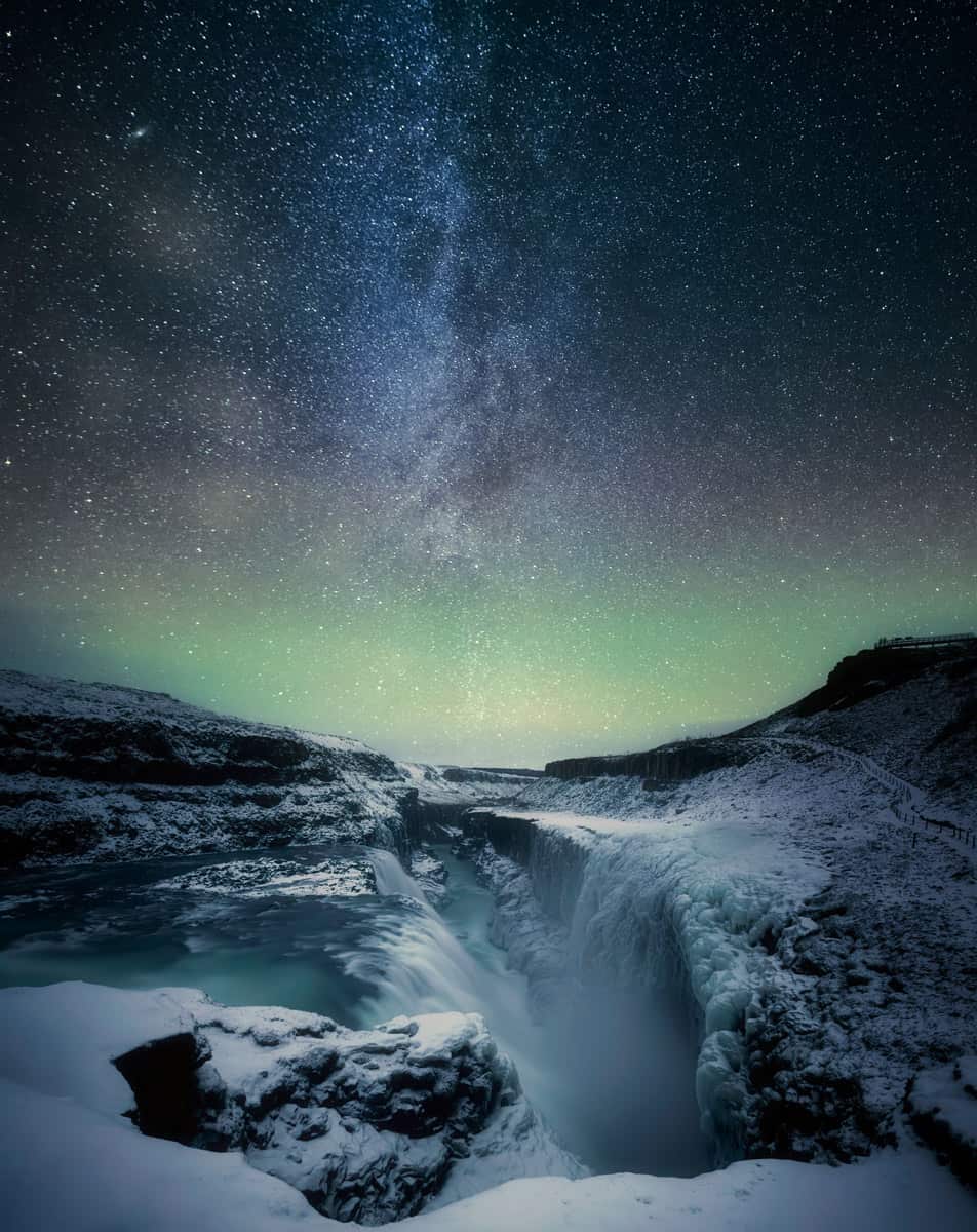
Gullfoss, also known as "Golden Falls," can be found in the Hvítá river canyon in southwest Iceland, and is one of Iceland's most famous and well-known waterfalls.
It is a part of the Golden Circle and is regarded by many as one of Iceland's most beautiful waterfalls.
Gullfoss has a remarkable history and is special in ways that you don't typically see in Icelandic waterfalls
The Hvítá river, which is the source of the waterfall, has various sources in the Highland of Iceland.
One of these is a glacier lagoon called Hvítárvatn lake located by Langjökull glacier in the Icelandic Highland.
The river is mainly made up of glacial water, but it also has spring-fed streams near the waterfall.From the lake, the river passes through the Highland before it reaches the gorge that forms the base of the Gullfoss waterfall.
The gorge's first step is 11 meters high, while its second step is 22 meters high. The gorge below the cascades, which have been carved out by the river for thousands of years, is around 40 to 50 meters deep.In addition to its natural features, the waterfall has thousands of horsepowers that flow into the gorge year after year.
It was believed that the natural features would be used to generate electricity to supply the people of southern Iceland with heat and light.In 1907, an Englishman approached the owner of the farm where the waterfall is located to see if he could use the natural features of the site for the construction of a hydroelectric power station.
At the time, Tómas Tómasson owned the farm that included Gullfoss; and he famously turned down the offer by saying, "I will not sell my friend!"

Foreign investors began renting the property in the 1920s, and plans to dam the Hvítá river at the hydroelectric project's location soon followed.
Sigríður Tómasdóttir, Tómas' daughter, attempted to have the rental agreement revoked but was unsuccessful.She then traveled to Reykjavik and made a vow to commit suicide by jumping into a waterfall if the project moved forward.
The rental agreement was terminated in 1929, and the falls were eventually purchased by the government in 1975, and subsequently declared a national monument.Sigríður, who is regarded as Iceland's first environmentalist, has a plaque commemorating her at the waterfall.
Sigríður had spent her entire life around Gullfoss. Around 1875, when tourists first started coming to the falls, she would guide them and create the first trail that led to the waterfall.
The Gullfoss waterfall is about 113 kilometers from Reykjavik.
It is situated in the Haukardalur Valley, in the south of Iceland, along the Hvitá river, not far from the Geysir Geothermal area, and is a stop on the Golden Circle Route of Iceland.
Take the Ring Road east for about 54 km from Reykjavik, then turn left onto Route 35. until you reach the Geysir geothermal area.
Continue driving for another ten minutes or nine and a half kilometers on Route 35 to reach the waterfall's parking area next to a visitor center.
GPS: 64.327242, -20.120005

Gullfoss high season is from early
June to late August.
A winter visit to Gullfoss can be truly magical, and sometimes even more rewarding than the crowded summer season.
The visitor center's waterfall viewpoint is well-maintained and accessible year-round.There are stairs leading to a lower portion of the waterfall, though, and this area can get very icy in the winter.If there is too much ice buildup, these steps can be closed.
A different trail leads to a waterfall overlook. Even though this area is open in the summer, it is usually closed in the winter.
Make sure that you have the right gear if you intend to explore Gullfoss in the winter, dependable snow boots and crampons.
The Westman Islands, also known as Vestmannaeyjar, are a group of 15 islands and 30 rock stacks on Iceland's South Coast.
And is arguably one of the country's best-kept secrets.
However, the spectacular nature, unique landscapes, friendly locals, the world’s largest population of nesting puffins, and fascinating history make a visit there worthwhile.
The only island that is inhabited is Heimaey, which is the largest of the group.
Although some sources assert that a fishing village had been established there 300 years earlier and that Irish monks had already visited Heimaey by that time, the island was first settled in 930 A.D.
The primary industry in the town of Heimaey, which has a population of about 4800, is commercial fishing.

Vestmannaeyjar is home to over 500 workers across two sizable plants and about 50 fishing vessels.
A hospital, a retirement community, and numerous schools are also located on the island.Its rich bird and marine life are proof of the Vestmannaeyjar's natural beauty.Visitors can explore the island on land as well as in the water thanks to the island's thriving ecotourism industry.
Around 10,000 years ago, several volcanic eruptions resulted in the formation of the 15-island archipelago. Surtsey, which was formed in 1963, is the latest one of them.
The history of the Westman Islands is both tragic and captivating. Starting with the first family to settle here at the very beginning of Iceland's history. Bloody invitations and a volcano erupting in the middle of town while everyone was sleeping.
The Westman islands are the only area of Iceland that had been subject to hostile foreign invasions during the 15th century.
English traders frequently raided the nation during this time. They killed one governor of Iceland and kidnapped another while buying local children, which gave rise to the urban legend that Icelanders sold their dogs cheaply but gave their children away.
Their main base of operations was on Heimaey, where they constructed the fortress Skansinn, which is still standing. But the English withdrew following a conflict with the Danes and the Hanseatic League in 1468–1473.The "Turkish Raid" in 1627 was the bloodiest foreign invasion to strike Iceland during this time.
It was carried out by Muslim-converted Algerians, Moroccans, and Europeans.However, the Ottoman Empire was held accountable for the incident because the captured people were later taken to Constantinople. An Icelandic law that forbade the murder of Turks was repealed in 1970.
The Turks killed and imprisoned hundreds of Heimaey residents during their invasion. Some of these were apprehended and set the church and warehouse on fire.27 of the prisoners were freed after paying a ransom and were returned to Iceland in ten years. The Turkish landing site is referred to as Ræningjatangi.

It was 1:45 at the morning of January 23, 1973, when explosion of fire started as Heimaey Island suddenly split open by an eruption in Eldfjall mountain (Fire mountain).
No one could have foreseen the devastation that would come along with this eruption,
but people were ready for a minor disturbance.Thankfully, the entire fishing fleet was in the harbor due to bad weather the previous evening.
The evacuation of all 5200 island residents who had to leave their homes quickly on this fateful night went smoothly thanks to a change to unusually good weather for that time of year.The residents of Heimaey had made every effort to withstand the disaster's initial effects,
but eventually, the strain became too much.
They came to the conclusion that they would never be able to go back to their houses,
and nobody was certain of how long it would take them to return to their island.One of the islanders' biggest worries was that the lava flow might affect the island's harbor and damage or close it.
Building walls to obstruct the lava flow into the harbor was something the islanders tried repeatedly.They eventually used pumps to pump seawater onto the lava to cool it down and control the flow, saving the harbor and even improving it.
Taking a ferry is the easiest way to get to Heimaey.
From Landeyjahöfn, a boat called the Herjólfur travels to the island. There, you can leave your car parked for the entire day.
Alternately, you could take your car on the ferry and drive around the entire island in just a few hours.
There are a number of comforts on the ferry, including a play area, refreshments, and indoor and outdoor seating areas.
The ferrie occasionally can't leave from Landeyjahunn due to unfavorable weather. Instead, they travel a short distance from Reykjavik to Þorlákshöfn harbor.


The southernmost point of Heimaey Island, Stórhöfði Cape, is one of the best places in Iceland to see Atlantic puffins.
It is about 10 minutes drive to get there from the town. It is possible to hike here as well, though. Depending on your pace, the hike can take 45-60 minutes.
A picturesque viewing area where you can see the Atlantic puffins is located 5 minutes walk from the Stórhöfði parking lot.There you can observe the puffins as they soar from their cliffside nests down to the sea to catch fish and come back to their nests.
Vestmannaeyjar is home to what is thought to be the world's largest population of Atlantic puffins.
This is not particularly surprising considering that during the summer, Iceland is home to about 60% of the entire world's population of Atlantic puffins.
Seljalandsfoss waterfall is one of Iceland's most breathtaking natural wonders.
This impressive waterfall cascades into a lovely meadow.
The main draw, however, is the paththat goes behind the water's curtain.
Seljalandsfoss is much more than just a waterfall to stand in front of and admire, and for all these reasons, it is probably the most well-liked and upbeat tourist destination in Iceland.
Seljalandsfoss is close to the ring road and is a short drive from Reykjavik if you rent a car
If you visit Seljalandsfoss during the summer, when everything is in bloom and the sun never sets, it is a great opportunity to go early in the morning or late in the evening to avoid the high-season tourist traffic.
But in the winter, you might have fewer visitors, but everything might be covered in snow and ice.
In our opinion, the scenery is even more beautiful in winter plus there is an opportunity to have the Northern Lights dancing above this amazing waterfall.
Whatever season you visit always be cautious when visiting, as the walking trails may be extremely slippery due to moisture from the waterfall or ice in the winter.


You should prepare to be drenched in mist when visiting the Seljalandsfoss waterfall.
You should bring a pair of waterproof pants, a coat, and waterproof boots in order to stay dry and comfortable.
If you don't have these, though, you might want to pack a few extra dry clothes in case you get too wet.The waterfall's access route and stairway are very slippery.
To avoid slipping, you should wear sturdy outdoor shoes of good quality.The viewing decks are extremely icy during the winter, making it challenging to navigate them without a pair of crampons.
Before venturing out into the countryside, you can rent a pair of crampons from camping supply stores.
Compared to other nearby areas like Geysir Geothermal, Seljalandsfoss's facilities are not as advanced.
It does, however, have sufficient fundamental amenities to accommodate guests, few restrooms, and a little gift shop.
The cost of parking at the waterfall is roughly 700 IKR, or $5.
It is the perfect place for a picnic, so if you bring some snacks or food with you make sure you leave no trash behind to preserve the waterfall's natural beauty.


A small hidden waterfall close to Seljalandsfoss is a must-visit.The name of this stunning waterfall is Gljúfrabúi, which means "Canyon dweller."
To get to it you must wade through a small river and enter a small cave.Once inside, you'll be in awe of the amazing waterfall and breathtaking light falling from above.
You'll need shoes with a good grip to avoid slipping on the wet rocks, and it's never a good idea to attempt this walk without crampons in the winter.
When entering this waterfall cave you will get wet, so be prepared, but it will all be worth it when standing there, calmly listening to the sound of the water, and simultaneously getting a reviving spray in your face it is surely like being in a "fairy tale."
Being in the presence of Skogafoss Waterfall is an incredibly moving experience.
With incredible width of 25 meters (82 feet) and a drop of 60 meters (197 feet), it is a sight to behold.
The water is directly poured from two glaciers, Eyjafjallajokull and Myrdalsjokull, blending in this breathtaking scenery that is frequently covered in spray and producing a magical single or double rainbow on sunny days.

According to the legend of Þrasi Þórólfsson, an educated man who passed away in 900 AD, he hid gold in a cave behind Skógafoss.
He is thought to have thrown the treasure into the waterfall because it is said to have magical properties.
At Skógafoss, people have looked for gold over the years. The waterfall has drawn a lot of visitors although it is unclear if there is gold there.
According to one legend, a young boy came close to finding the treasure chest but was unable to bring it back.He did not, however, leave empty-handed.
When he pulled on the rope he had tied around the ring on the side of the chest, it came off.
The gold ring was then given by the boy to the Skógar Church. The Skógar Folk Museum currently displays this exact ring, lending credence to the narrative.
If you are renting a car and going on a road trip, Skógafoss is about a two-hour drive from Reykjavik (155km).
Otherwise, Skógafoss is a stop on almost all South Coast tours we offer.You will be on Iceland's Ring Road going east the entire way, making the trip to Skogafoss Waterfall simple and direct.
Only 28 kilometers after passing Seljalandsfoss, you come to Skógafoss, which is on your left and is easily visible from the road.There are numerous dining, restroom, and lodging options at Skógafoss.
However, keep in mind that they are more expensive and more popular with tourists than smaller nearby towns.


The village of Skógar has a selection of dining establishments and lodging options despite its diminutive size.
The village's main structure was built in 1949. It was a school building but has now been turned into a hotel.The Skógar Folk Museum is right next to Skógafoss.
It safeguards the cultural heritage of the area. It has a variety of artifacts and tools, as well as a transport museum.
Overlooking the village's historic school and museum is the Völvuskógur forest. In this region, there are numerous hiking trails.
The Fimmvöruháls trail, which passes through the Mýrdalsjökull and Eyjafjallajökull glaciers, is one of the most well-known routes in the area.
The Abandoned DC Plane On the Sólheimasandur black sand beach, is a striking example of how man-made and natural elements can coexist to create an impressive scene.
The wrecked aircraft has a fascinating history dating back to World War Two and is a one-hour walk from the parking lot.
It only takes about two hours and ten minutes to drive to the abandoned plane from Reykjavik on Route 1 (Ring Road).
Between the town of Vík and the Skógafoss waterfall, the location is easy to find.
You drive for approximately 11 minutes (9,4 km) after passing the Skógafoss waterfall before reaching the designated parking area on your right.
About 3.5 km (two miles) from the parking area, the plane crash is in the middle of a black sand beach along the country's southern coast.


From the parking lot, The walk to the plane is a 7 km (4.3 miles) round trip across a flat desert and will take you 40 minutes to an hour each way, depending on your speed and the conditions at the time you visit.
Instead of walking, there are two other options available: taking the bus or renting a fat tire bike from the parking lot.
However, these services may be suspended due to weather conditions and the time of year.
Tickets can be bought on location.
It was on November 21, 1973, a Douglas DC 117 plane crashed in Iceland.It was delivering supplies to an American Army facility close to Höfn.
There are numerous hypotheses as to why the plane crashed. Some believe the aircraft's mechanical failure was to blame, while others believe the approaching storm was to blame.It's most likely that the plane crashed because it became stuck in the dense fog and encountered violent turbulence.
Additionally, the temperature dropped to below -10 degrees.The crew began to panic as the ice started to cover the aircraft, and they moved toward the mountain.
The plane's captain, Mr. James, made every effort to save the aircraft, but nothing seemed to be working in his favor.
Gregory Fletcher, the co-pilot, decided to make a perilous ocean landing. Although it was still a risky move, he decided to go ahead with it because his chances of survival were much better than hitting the mountain.

When they emerged from the clouds, the crew members were shocked. Instead of a lunar-like landscape, they saw a beach made of black sand.
They were headed for the Atlantic Ocean, but this image didn't leave them.The aircraft made an emergency landing on Sólheimasandur beach after it arrived at the icy sea. Despite the state of the plane, nobody was hurt in the incident.
The fuel tanks on the aircraft had holes, which is why it ran out of fuel, the crew was informed.To avoid becoming stranded at the crash site, the crew members contacted an army facility in Keflavik right away.
Then a rescue helicopter was sent to pick them up, and they were all brought to the hospital for a thorough medical examination.The US Navy later made the decision to search the crash site for additional valuables that might be recovered. The aircraft was abandoned at the beach after being emptied of everything it contained.
Rarely on Earth does one come across a beach with black sand.
Iceland's Reynisfjara or Black Sand Beach is considered to be one of the most beautiful in the world.
This is backed up by the fact that several magazines, including National Geographic and Condé Nast Traveller, have named this area one of the top ten most beautiful beaches in the world.

The Black Sand Beach is about 180 kilometers (112 miles) from Reykjavik at the southernmost point of Iceland.
It only takes about two and a half hours to drive to the beach from Reykjavik on Route 1 (Ring Road), so it can easily be completed in a half-day.
Or you can make it a full day when combined with other incredible sights waiting along the way.
Before reaching the town of Vik, simply turn right and head towards the coast.
GPS: 63.406333, -19.071306
Over millions of years, volcanic materials like basalt rocks and lava were eroded, leaving behind the distinctive black sand on Iceland's beaches.
When molten hot lava reaches the sea, it instantly cools to form black volcanic rock, which is then smashed into tiny sand fragments by the powerful waves and strong winds.
Almost all volcanic rock on the planet is basalt, which has a high iron content and absorbs light, giving the resulting sand its silky dark color.


More than 100 active volcanoes can be found in Iceland, and the country's black sand beaches are a result of the volcanic ash that has been left behind by eruptions over the years.
The interaction between the sea and the hot lava is incredibly violent when molten rock reaches it.
As soon as the lava enters the sea, it quickly melts, spewing out a massive amount of sand and debris.In just a few hours, a new black sand beach can be formed when enough lava flows into the sea at once.
The Katla volcano, which has been dormant for more than a century, is one of the most active volcanoes in Iceland. It is about to erupt once more.
One of the major eruptions of the Katla produced the black sand beach at Reynisfjara.
Reynisdrangar are the visual emblem for the village of Vík in Mýrdal.
They appear at the end of a dramatic stretch of Reynisfjara, the black sand beach, standing high beneath the Reynisfjall Mountain.
They dramatically emerge from the water and soar 66 meters (217 feet) into the air beneath the towering cliffs of mountain Reynisfjall.Langsamur, which stands 66 meters (217 feet) tall, is the tallest of the rock formations.
Landdrangur, the second-largest stack, is connected to Langsamur and is closest to the shore.The third column has the name of Skessa or troll, Skessudrangur.
And the last and smallest one has the ironic name Háidrangur which translates as "the highest one"The sea's hydraulic action or the impact of water on rock may be responsible for the Reynisdrangar formation.
When the strength of the water weakens the cliffs or headlands, the resulting cracks can eventually collapse and form free-standing islands or cliffs.

Local legend has it that a couple of trolls spotted a ship out at sea at night and waded out to catch it.
But as fate and timing would have it, dawn soon broke, turning the trolls into solid rocks.cAnother local legend claims that a man followed two trolls to Reynisfjara after losing his wife to them.
So that they would never launch another attack, he then froze them.The third local legend in the area claims that these volcanic columns are actually trolls, but if you compare these formations and the trolls in Faeroe islands, there are great similarities.
The legend says that trolls have attempted to unite the two countries by pulling them together, but dawn soon broke, turning the trolls into solid rocks.

The numerous natural features in Reynisdrangar, including the Hálsanefs cave and the Reynisfjara Black beach, have been impacted by the area's ongoing erosion and weather patterns.
Every time you visit the area, it will produce distinctive sights because of the constantly changing light and contrast in the weather and the elements.
The sea stacks of Reynisdrangar are home to tens of thousands of nesting seabirds. The Arctic Tern, Puffins, Fulmars, Guillemots, and Seagulls are a few of the species that inhabit this region.
The Dyrhólaey promontory, a 120-meter-high peninsula on Iceland's south coast, is well-known for its prominent position and natural arch.
Its name refers to a sizable arch that has eroded from the headland.The headland at the top of Dyrhólaey provides an excellent view of the Reynisdrangar and Vik village, as well as the black sand beache and the volcano Katla.
Dyrhólaey is a popular breeding location for Atlantic puffins and therefore a great location to explore the breathtaking views, awe-inspiring scenery, and ideal conditions to get up close and personal with Atlantic puffins.

At the base of Europe's largest ice cap, the Vatnajökull glacier, is where Iceland's natural crown jewel, Jökulsárlón, is located.
A place where huge chunks of ice break off the glacier and drift into a vast lagoon teeming with wildlife and beautiful scenery.
A must-see location on Lonely Planet's travel list, this totally surreal landscape features never-ending changes in appearance.

Jökulsárlón is located under Vatnajokull, the largest glacier in Europe on the South coast of Iceland, just by Route 1 (Ring Road)Getting to Jökulsárlón is simple for self-drivers.
The drive is about 5 to 6 hours 380km (236 miles) starting from Reykjavik.
But since the route to the lake is so picturesque, it might take you longer to arrive.
We advise taking at least two days when visiting Jokulsarlon because there are so many fantastic stops along the way.Additionally, you can travel to Jökulsárlón by taking bus number 51 from Mjódd, Reykjavk.
Costs about 11.000 ISK per person, and it takes about 6 hours.The bus runs on weekdays, Fridays, and Sundays (not Saturdays).
Jökulsárlón GPS:
64.081430, -16.229515
The Breiðamerkurjökull glacier began to recede in the 1930s, creating a small lake on the outwash plain.The melting of the ice also produced the black sand beach that lines the ocean.
More glacial meltwater accumulated in the lake over time as a result of the glacier melting.
The Jokulsarlon glacier lagoon became Iceland's deepest natural lake as a result of the glacier's movement.
Since 1970, the lake's size has increased fourfold, and it is still expanding.
With a current area of 18.2 km2, it is Iceland's deepest lake at a depth of 248 meters.


Although the lagoon is open and accessible all year round, boat tours are only offered in the summer and fall.
Kayaking and amphibian tours are the best way to explore the wildlife, to get up close with seals, birds and giant ice sculptures floating around the lagoon.
Boat cruises are not accessible during the winter due to a large number of icebergs.In the winter, though, the lagoon takes on a totally different appearance.
More ice is present throughout the winter, which leads to larger ice sculptures in different forms and sizes.
Additionally, there is little light pollution in this region, making it a Northern Lights heaven.
Diamond Beach is one of Iceland's most popular tourist destinations despite being six hour's drive from the city, and here's why.
From the greatest glacier in Europe Vatnajökull, massive pieces of ice that are over 1000 years old break away.
Float out to sea, drift then back to Diamond beach, and create some of the most fantastic scenery you can find.
Although the lagoon is open and accessible all year round, boat tours are only offered in the summer and fall.
Kayaking and amphibian tours are the best way to explore the wildlife, to get up close with seals, birds and giant ice sculptures floating around the lagoon.
Boat cruises are not accessible during the winter due to a large number of icebergs.In the winter, though, the lagoon takes on a totally different appearance.
More ice is present throughout the winter, which leads to larger ice sculptures in different forms and sizes.
Additionally, there is little light pollution in this region, making it a Northern Lights heaven.


Since Diamond Beach is composed of glacial ice, it may be visited all year round.
During the summer, the beach's enormous diamond ice blocks remain intact and continue to make their way to the coast for pictures.
During this season, the long hours of daylight and plenty of sunshine make it simpler to depart early for the beach and arrive before the crowds.
During the winter, the water may be unpredictable, making for spectacular images as waves crash on the shore.This time of year, the sun's golden glow may make Diamond Beach appear very attractive.
During the winter season, there is little light pollution in this region, making Diamond Beach a perfect place for Northern lights hunting.


